Sam McGee Trail

During our Canada Day long weekend in Carcross I was able to sneak in my second solo hike of the season.  My wife and daughter were joining me later that night,  so I headed out bright and early to find the trailhead for Sam McGee trail;  also known as Mountain Hero. 

Sam Mcgee Trail…aka, Mountain Hero

I had been really looking forward to this hike for a while.  I heard that the views from the summit were spectacular,  and the area is also steeped in history. At the turn of the 20th century the mountains in this area were prospected for silver.  Once mines were established at the higher elevations,  tramways were built to move the miners pay down to Tagish Lake before being loaded onto stern wheelers.   Today, there are a few tram towers and guy-wires still standing, and the odd bucket left abandoned, but the forest is slowing reclaiming her ground.  

Tramway Tower

To reach the trailhead, you head 17 kilometres south of Carcross on the South Klondike Highway towards Skagway, Alaska.   Once you pass the Conrad Campground, you continue for several kilometres more until you pass an abandoned tramway tower on the left side of the highway.  Just past this point there is a gravel road on the left, where you can turn off and park.  From there you cross over the road, head down the ditch embarkment and you’ll see the trailhead marker.  

Abandoned Tramway Bucket

Once I got on the trail I hiked through the forest until I reached a log bench at about the two kilometre mark.  This is a great place to stop for a quick rest and recharge before the elevation starts to really increase.   This hike is nine kilometres return, and you’ll make about 2000+ feet of elevation gain, but your prize,  aside from the fresh air, pristine nature and the tranquility of the forest is the stunning views once you reach the alpine.  

The trail follows some of the fallen guy wires.

Your views are largely obscured by trees on the ascent, but once you break the tree line you will be rewarded with panoramic views of the rolling alpine, and the towering mountains lining the valley.  To the East you get a stunning view of Windy Arm on Tagish Lake, while to the Northwest, the rugged views of Montana Mountain are awe inspiring.  

Windy Arm in the distance

My anticipation of this hike aside,  I must admit some nervousness venturing out alone into the remote backcountry so early in the day.  Bears are very active in the early morning and early evening, so I was on high alert for an encounter.   My experience has been that bears tend to avoid you if they can hear you coming so the last thing I wanted to do was catch one by surprise.  Luckily, I avoided any unwanted encounters, but here’s a link if you would like to be a little more prepared for possible bear interactions:  http://www.env.gov.yk.ca/environment-you/bearsafety.php

Montana Mountain

During this hike,  the views were certainly worth the effort,  but even more so,  I felt a sense of accomplishment.   When I was younger, I once had a wilderness instructor who liked to say that hiking is 90% mental and only 10% physical,  and I couldn’t agree more.  The body will follow where the mind directs it to go,  and sometimes,  it is that willful intent that allows you to make the final push.  I’ve found with solo hiking that mindful intent is the most important factor.  When you don’t have anyone else to push, or distract you,  its just you and your own thoughts that influence your ability to achieve the objective, and on this particular day, mental commitment was the key to a great hike.

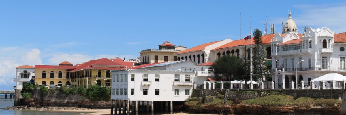
Carcross, Yukon

This Canada Day long weekend we were looking for a get away that wasn’t too far from home in order to meet some family commitments,  and Carcross presented the perfect opportunity to enjoy the weekend,  and allow me to kick off my first blog specifically highlighting a Yukon community. 

Carcross Community Sign

Carcross, Yukon is approximately an hour southeast of Whitehorse on the South Klondike Highway.  It was originally named Caribou Crossing until 1904, when the name was changed to alleviate confusion over mail delivery with another community.  The original name reflected the vast number of caribou that would migrate through the area until the herd was decimated around the time of the gold rush.  Today,  Carcross is developing a reputation as a world class mountain biking destination, and caters to tourist coming up from the cruise ships that arrive in Skagway Alaska.  

Oldest General Store in the Yukon

If you’re coming from Whitehorse, the drive to Carcross will take you through some breath taking mountain scenery, and there is a hidden gem along the way.  Forty kilometres from Whitehorse you’ll pass by a rest area called Robinson Roadhouse.  If you pull in,  there is a trail head that is hard to see from the road,  but it will open up into an expansive clearing that has a number of old log buildings which are the last remaining testament to this popular waypoint for weary travellers in the early part of the 20th century.  I’ve always been surprised that this spot isn’t better advertised.  

Robinson Roadhouse Heritage Site

You’ll also pass by Emerald Lake, and you absolutely have to stop at this lookout to view the beautiful emerald waters that sparkle in the sunlight.   The colour is the result of calcification (marl) on the lake bottom that reflects the brilliant colour of the water.  

Emerald Lake

From there you continue towards the community and will pass by the Carcross desert two kilometres north of town.   Often dubbed the smallest desert in the world,  it is actually the remains of a long dried glacial lake.  Measuring approximately one mile across,   it is a really nice walk to hike the perimeter and explore the area.   I recommend going barefoot;  the sand is actually nicer than many beaches I’ve been to in the tropics. 

Carcross Desert

The community of Cacross itself is within the traditional territory of the Carcross/Tagish First Nation,  and over the last few years they have built a spectacular cultural centre on the shore line as you drive into town.   I’m not sure what their ultimate plans are for the building,  but in the lobby they have some really amazing wood carved statues,  which makes for a beautiful display.    Carcross/Tagish First Nations is also working with the Yukon Government to bring back the caribou herd, with some very positive results;  in one of my previous blogs we went on a snowmobile rally this winter for some wildlife viewing in search of this very herd.   

Carcross/Tagish First Nation Cultural Centre

This community is undergoing an amazing transformation.   When I first visited the Yukon as a teenager,  there was really nothing to speak of in Carcross.  A small community,  surrounded by beautiful lakes and mountains,  but nothing really to draw people to the area.   Over the past few years,  the community has partnered with various levels of government to develop a tourism hub, which has included the development of their mountain bike and hiking trails,  as well as the construction of the Carcross Commons.  

Carcross Commons

In all my travels,  the Carcross Commons ranks high for me as a really amazing idea.   It is essentially a large outdoor deck that has small micro businesses that line the outskirts of the central area.   Along with a visitor centre,  the small businesses for the most part are local artisans that are selling all kinds of arts, foods, and souvenirs.   The overall vibe of the area is very laid back, artsy and relaxing.  You can grab a coffee and wander the shops,  watch the Whitepass train roll by, walk down to the beach at Lake Bennet or just chill out.  

Beach at Bennett Lake

While we were there,  I also took the opportunity to do my second solo hike of the summer on the Sam McGee Trail,  also known as Mountain Hero.  In my next blog post I’ll share with you some of the spectacular hiking this area has to offer but in the meantime,  I recommend a visit to Carcross if you’re coming to the Yukon.   This community continues to grow and develop itself as a destination niche, but for now it’s still maintaining the quaint, authentic Yukon feel that I love;  and I for one hope they never lose that atmosphere.  

Cultural Centre Wooden Statue

Fish Lake Hike

My wife was away,  and I was flying solo for the week, so I decided to do a mid-week hike with the kids,  and Fish Lake trail was a great option.  It’s easy to access and close to town,  with spectacular views.  After getting the kids on board,  we made some sandwiches, loaded up the dog and headed for the hills.  

Pit stop before our final ascent

Fish Lake is only 15 kilometres from Whitehorse, and is a very popular outdoors spot year round.  During the summer,  it’s a great place for hiking, fishing and boating.  There is an adventure ranch nearby, and if you’re so inclined,  you can take a horseback tour of the surrounding area.  We’ve done this a few times,  and it’s a great way to see the back country. 

Breaking the tree line

To access the trailhead you drive along Fish Lake Road until you reach the lake. Once on the dike, turn right and follow the road until it turns into a narrower dirt road and arrives at a fork with enough room to turn around.   You can park here,  and the trail head is straight ahead of this point.   

Fish Lake view from the shoreline

You are going to make about 1100 feet of elevation gain from the trail head to the summit,  with the majority of the climb in the tree line.  Once you break into the sub-alpine,  the incline starts to level out, and you will reap the visual rewards of your efforts.  The trail moves through the scrub along a well worn trail to the base of the first summit.  From there, it’s an easy ascent,  with spectacular views of Fish Lake, and the valley behind.  At this point,  you’ll see the topography between the first summit and the second summit forms a saddle,  and it is an easy hike to move between them.  

Sub-alpine towards the summit

The trail itself from the start of the subalpine follows a seasonal creek bed, that was still shedding winter run off in spots.  You’ll find this part of the trail a little muddy and slick.  The trail is used by the horse tours, so you’ll run across sections of manure as well, so watch your step.  Also, this is the Yukon,  so bring your bug spray!   Once you break the tree line the wind helps to keep the bugs at bay,  but in the trees you’re a moving buffet for mosquitoes and no-see-um’s, and they’re hungry. 

Run off on Fish Lake Trail

For me,  a large part of hiking is self reflection,  and I learned something on this hike;  I’m getting older.  For years I always slowed my pace to keep the hike enjoyable for the kids,  and in a very short amount of time they have physically matured to the point that it seems like they could sprint up the mountain,  and I found myself bringing up the rear going up and coming back.  Although I am infinitely proud of their abilities,  I can’t help but feel my age.   Somewhere along the way hiking poles have crept into my standard gear,  and rest breaks seem to come a little more frequently.  I could make excuses like this was an evening hike after a long day of work, and the temperature was 25 degrees above, etc, etc…, but none of that changes the fact that I am starting to feel the march of time;  and this reinforces my feeling that I need to do more,  I want to do more,  and I can do more….but I really need to recalibrate the work life balance.  The views from my office will never compare to these.

Fish Lake view from the summit

With that in mind,  if you have the time,  this is a very enjoyable hike.  From a difficulty level, I would rate it as easy.   The path is well marked, it’s easily accessible,  and you get to move through the different zones of the forest, sub-alpine and alpine.   The views are spectacular,  and you get a really good perspective of the surrounding landscape on both sides of the valley;  and I guarantee that if you are stopping to have dinner on the summit you’ll have the best view in the house. 

Opposite side of the valley